Baltimore Greenway Trails Network
Baltimore Greenway Trails Network
Baltimore, MD
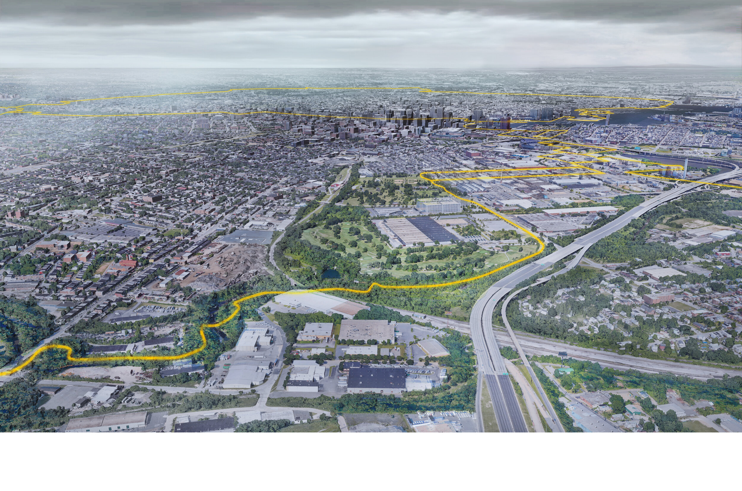
Baltimore’s park system is one of the nation’s oldest and most comprehensive, originating from reform-era urban parks (Druid Hill Park, Patterson Park) into citywide system of urban forests, civic parks, riparian corridors and verdant parkways in the 1904 Olmsted Brothers Plan. Brilliantly tied to the City’s natural hydrologic networks, the Olmsted Plan foresaw the need to provide connectivity for people in alignment with the protection of our natural resources. Today, the Baltimore Greenway Trails Network seeks to build on the Olmsted Plan to create a 35-mile off-street trail network for all modalities that connects existing and planned trail systems.
The network builds upon three existing trails (Gwynns Falls, Jones Falls and Herring Run Trails) and is currently in planning stages to develop and secure 10 additional miles to complete the loop, providing residents with a safe and active way to access the city’s major institutions and destinations, including universities, hospitals, museums, parks, schools, waterfronts and employment centers.
Unknown Studio worked with the Rails to Trails Conservancy and Bikemore to create a series of visualizations that clearly communicate the existing and proposed alignments of the trail system, articulate proximity of the network to well known landmarks and local places, and showcase the transformative “power of a trail” in connecting communities, circuits, and landmarks across the City.
Project timeline: 2020
Client: Rails to Trails Conservancy
Scope: Visualizations, Mapping
Project Type: Waterfront | Park | Urban
Size: 35 Mile Network